Overview
Version 7.2.2 includes updates and fixes to the Work Manager mobile app, a new inspection teams screen in the Structures Inspector product, as well as general bug fixes to the application platform of the AgileAssets asset management system.
Supported Third Party Applications and Versions
Supported Platforms and Third Party Applications for Version 7.2.2
New Features and Enhancements
Work Manager
- Added an option on the map to locate and show a user's current location.
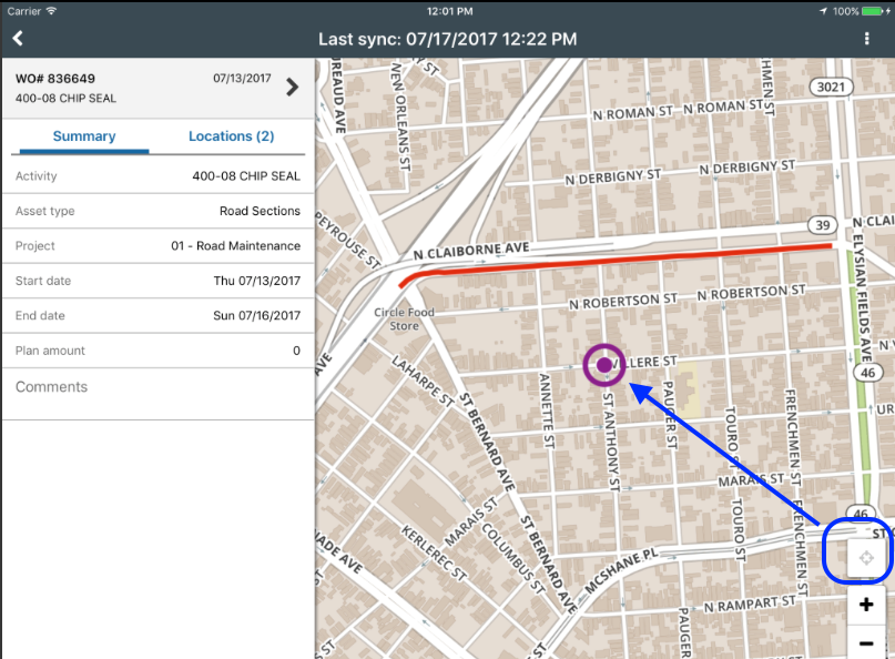
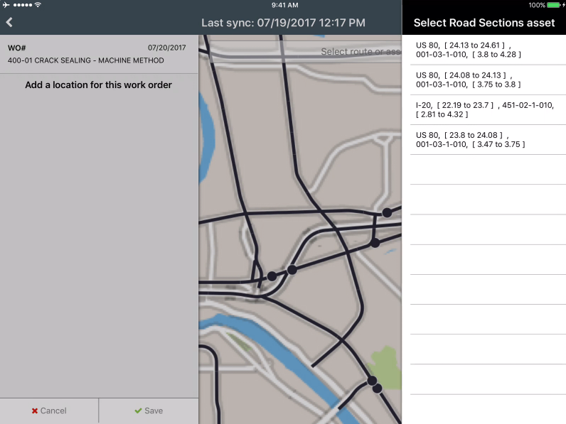
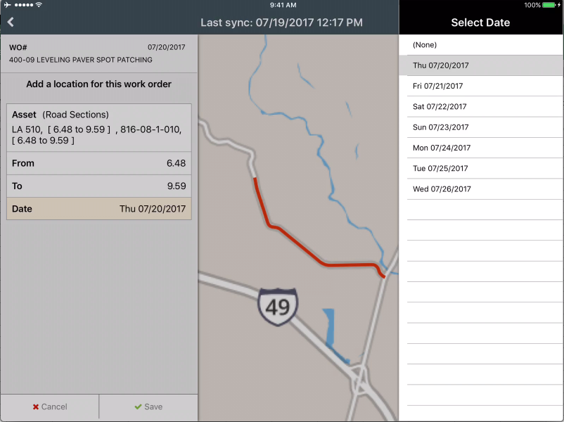
- Added the ability to add a location to a day card by selecting an asset on the map
- Updated the work date field to be an optional entry on location day cards
Structures Inspector
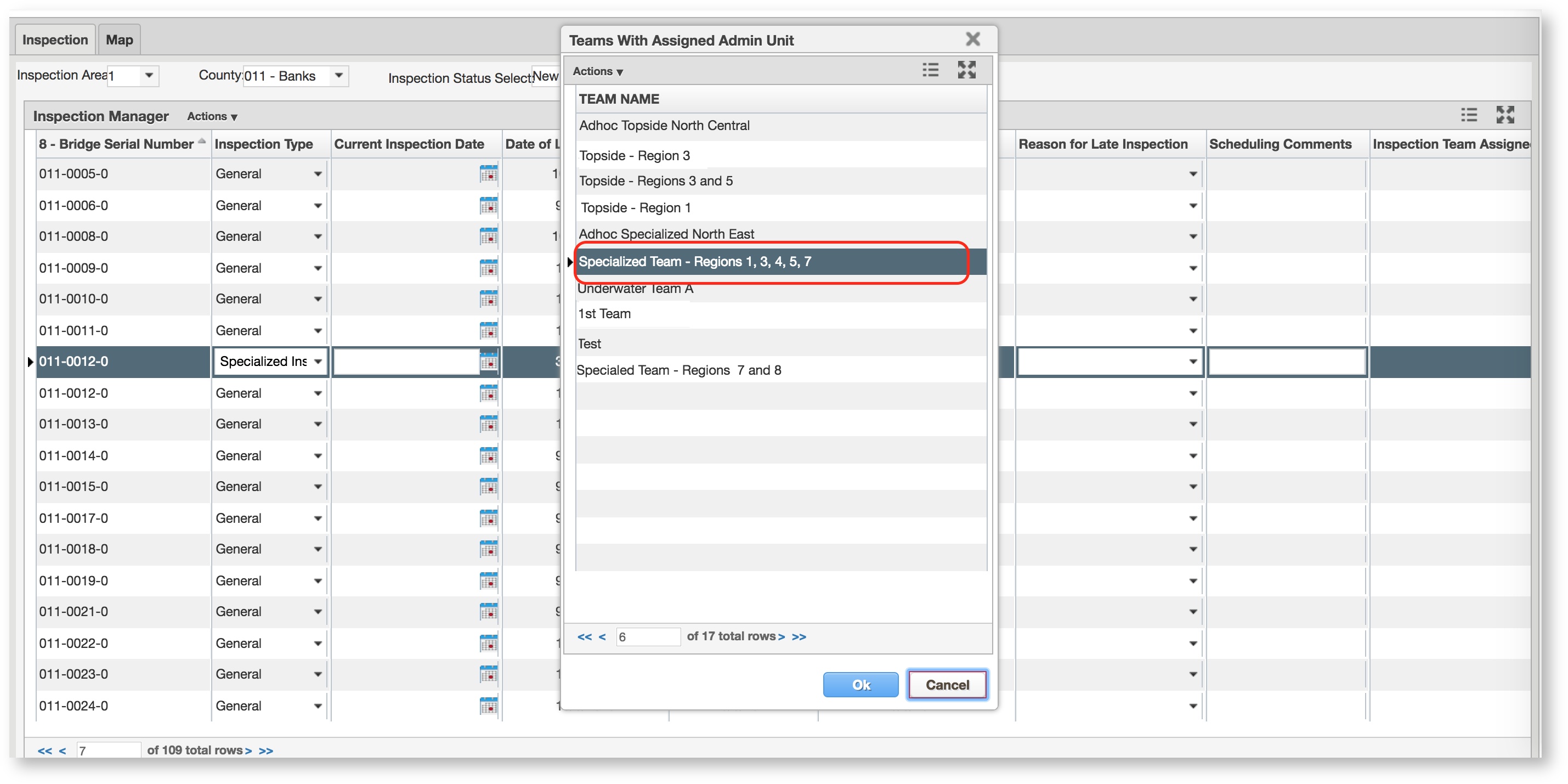
- New Inspection Teams screen allows an inspection coordinator to create a team of inspectors that can be assigned bridge structures for inspection
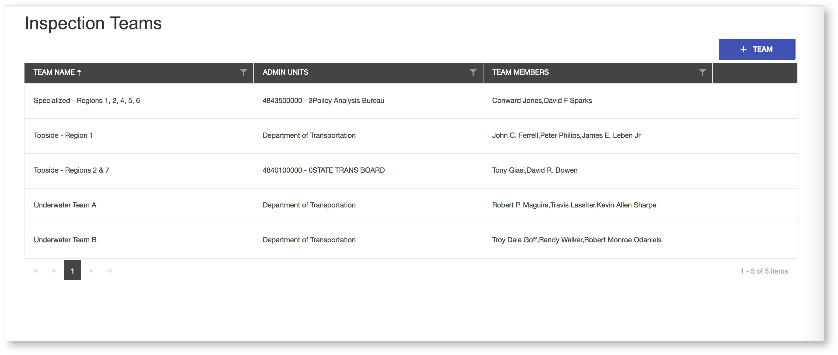
- Enhanced Inspection Manager screen allows an inspection coordinator to assign new inspection candidates to an inspection team
Dropped/Replaced Features
- This version drops support for Esri Roads & Highways version 10.3.1 and below
Bug Fixes and Other Improvements
- Added: Support for ESRI Roads & Highways V10.5.1
- Added: High Contrast mode display for color blind users, this applies a grey highlight over white text on grid views
- Fixed: Issue in bridge inspection, where a filter could not be applied to some columns on a data window
- Fixed: Issue in bridge inspection, where the user and date update fields are not updated to reflect current status, when 'Setup Condition State Filter' is updated
- Fixed: Issue in bridge analysis, where an error is returned when attempt to edit item scope description for a copied analysis scenario
- Fixed: Issue in maintenance management, where the last section selected in the 'Inv Elem' field from a previous work order creation is retained when creating a new work order
- Fixed: Issue in fleet management, where the labor cost for a repair order was not correctly summing the only costs from the labor day card for the repair order
Known Issues, Limitations & Restrictions
- The new GIS Interface like all web mapping applications requires datasets in the geographic coordinate system (EPSG:4326), so customer schemas with data stored in a different coordinate system must be transformed in order for map layers to be created from the dataset.
- Inserting a location or inventory item from a map is not functional when using Firefox as your web browser. To work around this limitation, use the other supported web browsers: IE 11, Chrome or Safari
- When you select to print a map as an image (png file) whilst using Firefox as your web browser, the file is downloaded as map.png.pdf. You would have to manually edit out the '.pdf' extension from the file name, after the file has been downloaded, to be able to open/use the file
- When you define a map print template of size 34x44 or larger, an error is returned since the size of the generated map image always times before a pdf for printing is generated
- While working on the GIS Interface and performing tasks that does not generate a request to the server (such as styling a map), your user session may expire as a result. The configured session expiration warnings will be displayed when this occurs or your session may timeout and a session expiration notification displayed, if a warning is not configured
- Map filter value does not get pre-populated in the Jasper report print template, even though the parameter is specified for display in the template
- Map filter value cannot be defined or edited for a map with a specified area of interest. To work around the definition limitation, the map filter should be defined before the AOI is set
- A map's layer style settings become null and uneditable, when an applied filter is partially applicable or not applicable to the defined styling attribute values for the map
- On a map bound to a data window, some items when selected on the map aren't highlighted in the data window because they aren't present there (In a data window, items can be Access Regulated), but on the map all inventory items are displayed
- The loading and display of maps and associated styles in IE 11 is not as fast as Chrome, Firefox and Safari
- In the Roads & Highways interface, routes with curves are not handled properly by the ESRI FDGB API. A workaround is to have the agency densify the routes to turn the curves into line strings
- The HTML5 based copy/paste functionality has limitations on the number of rows that can be copied to a browsers clipboard
- IE 11 - 4000 rows
- Edge - 4000 rows
- Chrome - 400 rows
- Firefox - 1000 rows
- IE or Edge on a Surface Tablet - 15 rows
- When you select to copy rows from a data window, data from hidden columns on the window are also copied to the clipboard
- The spinner indicating that a layer is loading in the GIS Explorer, continues to spin after selecting to remove a previous loading layer by using either the new map or remove layer option
- When zoomed in at the 0.6km/0.4m level before selecting to print a map, the basemap is not rendered on the resulting printed map
- Hebrew and other languages with special characters are not rendered properly on the properties panel of GIS Explorer
- GIS Explorer does not display the contents of the screen for a right to left language setting
- For some monitor resolutions, opening the messages dialog while the GIS Explorer window is open results in the messages dialog to be partially hidden
- In FDC, when enter an incorrect password twice and then enter the correct password afterwards, a message indicating an incorrect reCAPTCHA answer is displayed
- When the same editable layer is added to GIS Explorer so there are more than one active, the features on the layer cannot be dragged for an edit
- The undo/redo of edits retains the actions performed even the associated layer has been removed
- When add a new editable layer to a map with in-progress edits, the undo and redo options are temporarily disabled. Performing an edit re-enables undo/redo and previous edits can be undone or redone
- When a user a user enters an incorrect username or password in the Work Manager mobile app, an incorrect message 'Unable to connect to server' is displayed
- In Microsoft Edge, some admin units in the Admin Units dropdown on the inspection teams creation dialog, appear as actionable links