What's New
Functionality and interface updates to the Work Manager mobile app as well as improvements to several web applications and bug fixes.
New Features and Enhancements
Work Manager mobile app
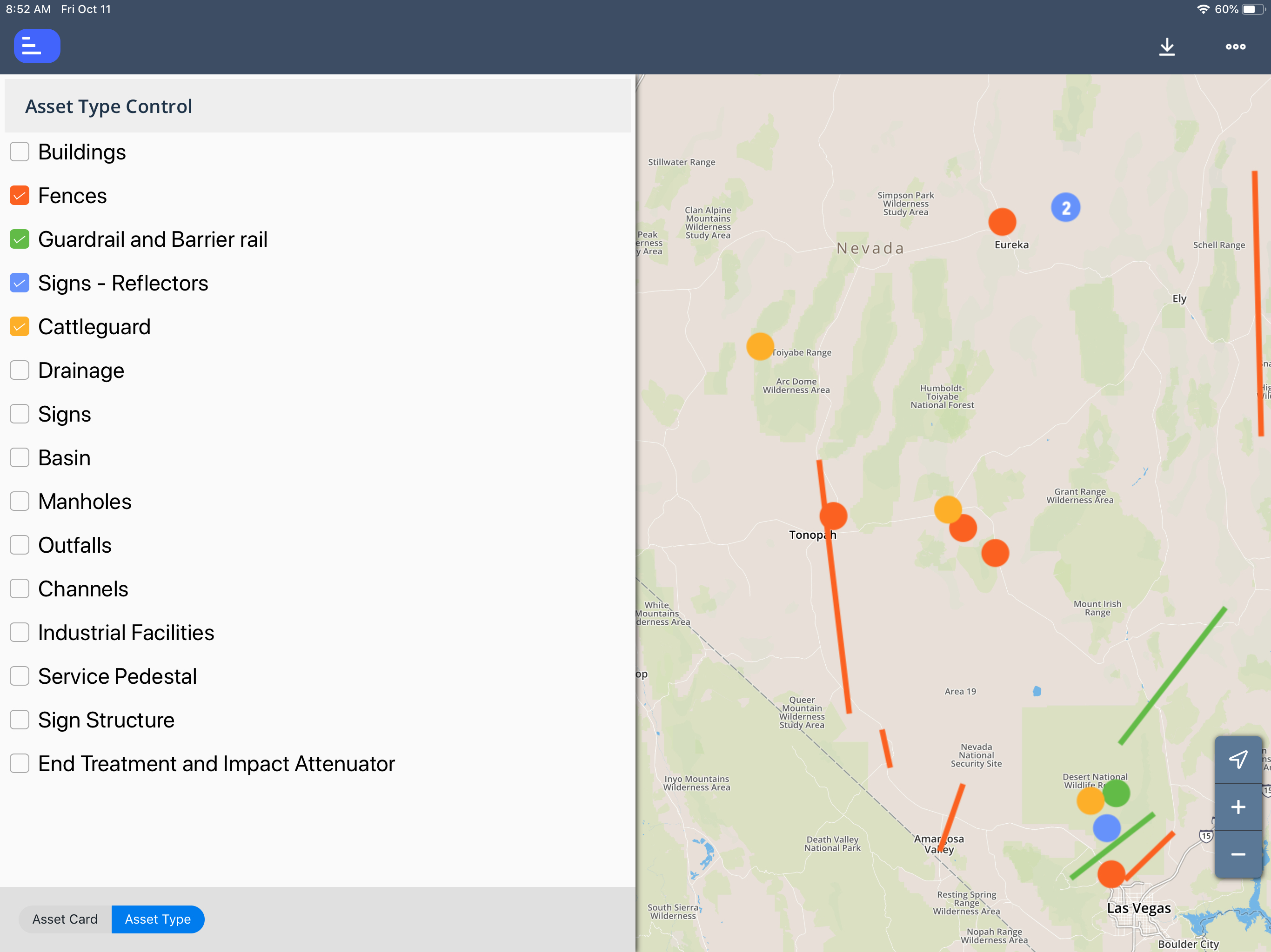
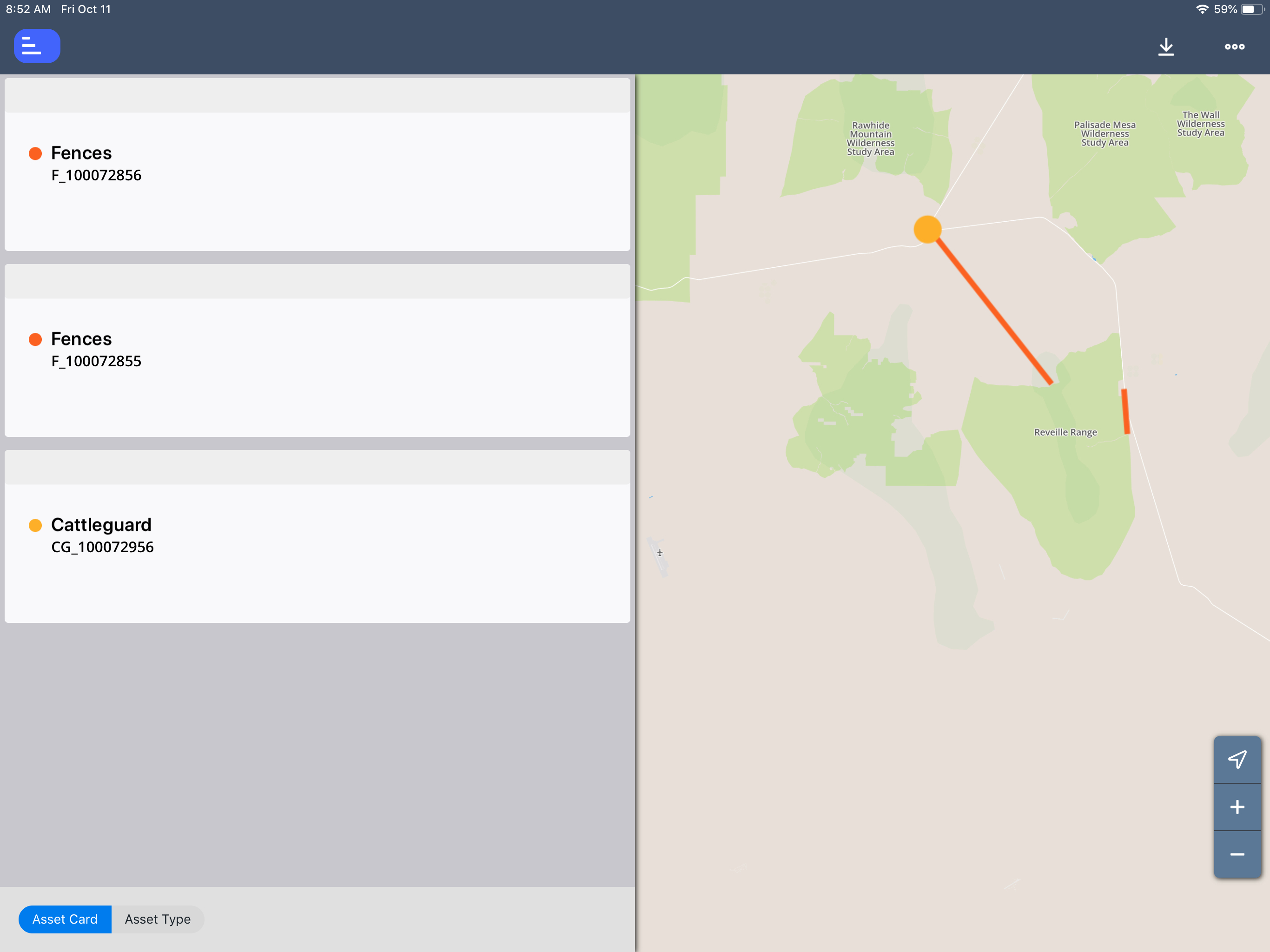
When clicking on the Assets option, Asset Types can be selected and the asset cards are now visible on the left side of the map.
Structures Inspector
- Inspection coordinators can now easily deactivate obsolete inspection teams.
Maintenance Manager
- Users can now share just selected asset types across multiple admin units. This allows for a much shorter list of assets to browse through.
Roads and Highways
- Users can now configure the LRS retire behavior for tables and assets. For assets where the linear location is retired, the assets status can be set to configured asset status. It is also possible to configure clear linear location or delete.
Other Improvements and Bug Fixes
- Added: In GIS Explorer, users can now create a database layer using a view column. The column bust be an integer and the be actual primary key for the features on the grid. The resulting layer will be read only.
- Fixed: Issue in Asset Inventory has been resolved and the year no longer includes a comma in filtering windows.
- Fixed: Issue in Fleet App has been resolved and default values are now determined based on customer data for the Parent Activity ID.
- Fixed: Issue in Pavement Management has been resolved and the property pop-up window opens even if a 404 error for LRS info appears.
- Fixed: Issue in Maintenance Manager has been resolved and new users using SSO are no longer prompted to change password.
- Fixed: Issue in Sign Manager has been resolved and users can now edit an asset in the pop-up from the Work Orders window.
- Fixed: Issue in Structure Manager has been resolved and all records are now exported to KML files whether they have coordinates configured or not.
- Fixed: Issue in Structure Manager has been resolved and inspections can now be approved without error.
- Fixed: Issue in Structures Inspector App has been resolved and annotation notes on flag photos now sync correctly.
- Fixed: Issue in Structures Inspector App has been resolved and button text no longer truncates on small screens.
- Fixed: Issue in Structures Inspector App has been resolved and photo IDs are no longer duplicated when photos are uploaded to both the web and app.
- Fixed: Issue in Structures Inspector App has been resolved and photos now appear correctly in the photo roll.
- Fixed: Issue in Structures Inspector App has been resolved and the app no longer crashes when adding photos to a tab with over 25 existing photos.
- Fixed: Issue in Structures Inspector App has been resolved and unnecessary condition notes are no longer created in the web after syncing from the app.
- Fixed: Issue in Structures Inspector App has been resolved and users no longer receive an internal system error when syncing data.
- Fixed: Issue in Structures Inspector has been resolved and geometry handling no longer affects approving and finalizing inventory.
- Fixed: Issue in System has been resolved and activity code description changes can now be saved along with other activity code changes.
- Fixed: Issue in System has been resolved and the Dynamic Aggregation tool can now create homogeneous sections by aggregating data according to user defined rules using lane-specific data.
- Fixed: Issue in System has been resolved and users can now select a country in the management units window.
Known Issues, Limitations, and Restrictions
- Work Manager App users on Android devices with memory of less than 2GB may receive an Out of Memory Exception. Please close and reopen the app daily to avoid this issue.
- Work Manager App occasionally crashes on Android devices when navigating quickly between several pages.
- When a user adds multiple photos to an inspections from a device with a full camera roll on an Android device the Structures Inspector mobile app may crash.
- The Work Manager mobile app may crash when navigating quickly between pages on Android devices.
- The Work Manager mobile app keyboard overlaps some fields when expanded on Android devices.
The Structures Inspector mobile app lists inspections in QC and QA for download but if those inspections are edited, the sync process will halt and users must click Delete on device and continue to sync their other inspections.
When downloading for the first time, please check the status of inspections and do not download inspections with a QC or QA status. To review the status of inspections that have already been downloaded, click
 and select Download Inspections.
- The Structures Inspector mobile app Condition State comment text box covers the tittle.
- The Structures Inspector mobile app lists the date updated as the date it was last modified from the web application even if it has been modified more recently in the mobile app.
The supplied CORS filter for Tomcat will not work on Tomcat version 8.5.32 and above. Customers need to review the use of the CORS filter and update web.xml as needed. Additional information can be found at https://tomcat.apache.org/tomcat-8.5-doc/config/filter.html
- The discovery date is absent on the flag screen in Structures Inspector. Currently, the default date is the current date for flags created in the web app.
- The Structures Inspector mobile app screen shifts when closing a pop-up window.
- Flags can now be created in the Structures Inspector mobile app but must still be submitted to QC using the web application. Additionally, Flags Superseding and Discovery Date are not yet available in the app.
- When syncing the Structures Inspector App on a Windows OS, the map closes up and has to be refocused using the zoom controls.
- Flags cannot be set to supersede each other in the Structures Inspector mobile app.
- When multiple users of the Work Manager app use the same device, they will be able to see all unsynced changes on that device from their sync screen.
- On Windows 10 devices the Structures Inspector app freezes when saving an edited photo to attach to a condition rating.
- As of Chrome 71, browser pop-ups may be blocked which will negatively affect system operations. To address this in Chrome go to Settings > Advanced > Content Settings > Pop ups and redirects and then add the URL for the application.
- The new GIS Explorer like all web mapping applications requires datasets in the geographic coordinate system (EPSG:4326), so customer schemas with data stored in a different coordinate system would need to be transformed in order for map layers to be created from the dataset. See the section on re-projecting geometries in the Implementation Guide
- Inserting a location or inventory item from a map is not functional when using Firefox as your web browser. To work around this limitation, use the other supported web browsers: IE 11, Chrome or Safari
- When you select to print a map as an image (png file) using Firefox as your web browser, the file is downloaded as map.png.pdf. You would have to manually edit out the '.pdf' extension from the file name, after the file has been downloaded, to be able to open/use the file
- When you define a map print template of size 34x44 or larger, an error is returned since the size of the generated map image always times before a PDF for printing is generated
- While working on the GIS Interface and performing tasks that does not generate a request to the server (such as styling a map), your user session may expire as a result. The configured session expiration warnings will be displayed when this occurs or your session may timeout and a session expiration notification displayed, if a warning is not configured
- Map filter value does not get pre-populated in the Jasper report print template, even though the parameter is specified for display in the template
- Map filter value cannot be defined or edited for a map with a specified area of interest. To work around the definition limitation, the map filter should be defined before the AOI is set
- A map's layer style settings become null and un-editable, when an applied filter is partially applicable or not applicable to the defined styling attribute values for the map
- On a map bound to a data window, some items when selected on the map aren't highlighted in the data window because they aren't present there (In a data window, items can be Access Regulated), but on the map all inventory items are displayed
- The loading and display of maps and associated styles in IE 11 is not as performant as Chrome, Firefox and Safari
- In the Roads & Highways interface, routes with curves are not handled properly by the ESRI FDGB API. A workaround is to have the agency densify the routes to turn the curves into line strings
- The HTML5 based copy/paste functionality has limitations on the number of rows that can be copied to a browser's clipboard
- IE 11 - 4000 rows
- Edge - 4000 rows
- Chrome - 400 rows
- Firefox - 1000 rows
- IE or Edge on a Surface Tablet - 15 rows
- When you select to copy rows from a data window, data from hidden columns on the window are also copied to the clipboard
- The spinner indicating that a layer is loading in the GIS Explorer, continues to spin after selecting to remove a previous loading layer by using either the new map or remove layer option
- When zoomed in at the 0.6km/0.4m level before selecting to print a map, the basemap is not rendered on the resulting printed map
- Hebrew and other languages with special characters are not rendered properly on the properties panel of GIS Explorer
- GIS Explorer does not display the contents of the screen for a right to left language setting
- The owner of a GIS catalog folder no longer has access to the catalog, when the folder is shared by a GIS admin with administrative units that the owner of the folder does not belong to
- A map built from an image service is not rendered in the printed document (PDF or PNG) when select to print the map
- An image layer is not displayed on the map when change the basemap from the 'None' option to any other basemap option
- A map comprised of layers from multiple sources including an image service, does not display the layers in the correct z-order when the layers are re-ordered
- For some monitor resolutions, opening the messages dialog while the GIS Explorer window is open results in the messages dialog to be partially hidden
- In FDC, when enter an incorrect password twice and then enter the correct password afterwards, a message indicating an incorrect reCAPTCHA answer is displayed
- When the same editable layer is added to GIS Explorer so there are more than one active, the features on the layer cannot be dragged for an edit
- The undo/redo of edits retains the actions performed even the associated layer has been removed
- When add a new editable layer to a map with in-progress edits, the undo and redo options are temporarily disabled. Performing an edit re-enables undo/redo and previous edits can be undone or redone
- When a user a user enters an incorrect username or password in the Work Manager mobile app, an incorrect message 'Unable to connect to server' is displayed
- In Microsoft Edge, some admin units in the Admin Units drop-down on the inspection team's creation dialog, appear as actionable links
- Setting some columns as fixed in a data window is not functional in IE 11
- Setting of columns as fixed in a data window is not supported in right to left language displays, such as for Hebrew or Arabic, i.e. only the left most columns can be fixed
- GIS Explorer does not display a basemap nor the basemap selection dialog, when using Microsoft Edge web browser. However, basemaps function as expected with IE 11, Chrome and Firefox web browsers
- There is an issue in ESRI ArcGIS Enterprise 10.6.1, that prevents the publishing of services for Oracle tables or views with a geometry column owner of MDSYS. When the ESRI issue is addressed, we will test and ensure that the functionality has been restored
Supported Third Party Applications and Versions
| Platform | Version | Notes | |
|---|---|---|---|
| Application Server | Apache Tomcat | 8.5.X, 9.X | |
| Java | Oracle Java SE | 8.0 | |
| Oracle JDK | 1.11 | ||
| OpenJDK | 1.11 | ||
Web Browsers | Internet Explorer | 11 | Users may need to disable "Display intranet sites in Compatibility View" option |
| Edge | 20.X or newer | ||
| Chrome | 61 or newer | ||
| Firefox | ESR 60 | ESR 68 projected for start of July 2019 | |
| Mobile Safari | iOS 10.X, iOS 11.X | Safari is coupled with iOS, so the version of Safari is tied to the OS versions supported. | |
| Database Servers | Oracle Enterprise Edition | 11g (11.2.0.4.0) 12c 18c | 11.2.0.3.0 reached EOL August 2015 Note that 11.2.0.4 is in the extended support since January 2015 but support Fee waived until May 31, 2017 |
| PostgreSQL | 9.4.X, 9.5.X 9.6, 10.3 | Note that ESRI ArcGIS Enterprise with 10.6 includes support for 9.6 (in addition to 9.4.x and 9.5.x) http://desktop.arcgis.com/en/system-requirements/latest/database-requirements-postgresql.htm | |
| Server Operating Systems | MS Windows Server | 2008 R2 64-bit or newer | |
| Red Hat Enterprise Linux | 5, 6, 7 | ||
| FDC | OS | Windows 7 Professional Windows 10 Professional | Same as standard application with the exception of the Operating System and Database |
| Database: Oracle Express Edition | 11g | ||
| Reporting | Jaspersoft, iReport | 4.X, 6.X, 7.x | |
| Mobile Apps | iOS | 10.X, 11.X | |
| Android | Lollipop - V5.0, V5.1 Marshmallow - V6.0 Nougat - V7.X Oreo - V8.X | Notes:
| |
| Windows 10 | All UWP supported devices with touchscreen capability. Note: The Fleet Maintenance Manager and Materials Manager mobile apps are not supported on Windows 10 | ||
LRS Interface | ESRI ArcGIS Enterprise | 10.5, 10.5.1, 10.6 | For the Roads & Highways Interface |
| GIS | ESRI ArcGIS Enterprise | 10.5, 10.5.1, 10.6 | For integrated ArcGIS Enterprise |
| Application Deployment | Docker |