Overview
Version 7.2.6 includes updates and fixes to the Work Manager mobile app, as well as general bug fixes to the AgileAssets asset management system application platform.
Supported Third Party Applications and Versions
Supported Platforms and Third Party Applications for Version 7.2.6
New Features and Enhancements
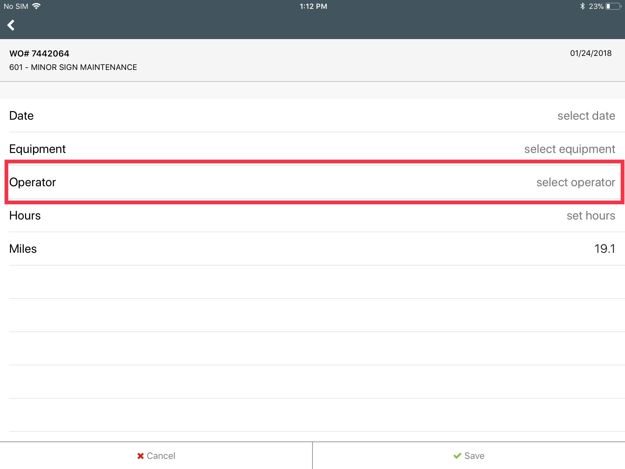
Work Manager
- Added ability to specify an Equipment Operator on a work order
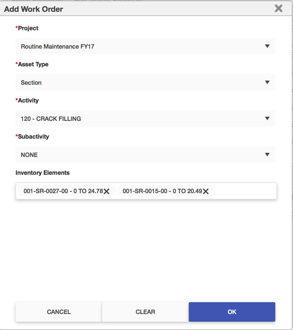
Maintenance Manager
- Refreshed user interface for creating a work order from the Daily Work Report and Plan Matrix windows
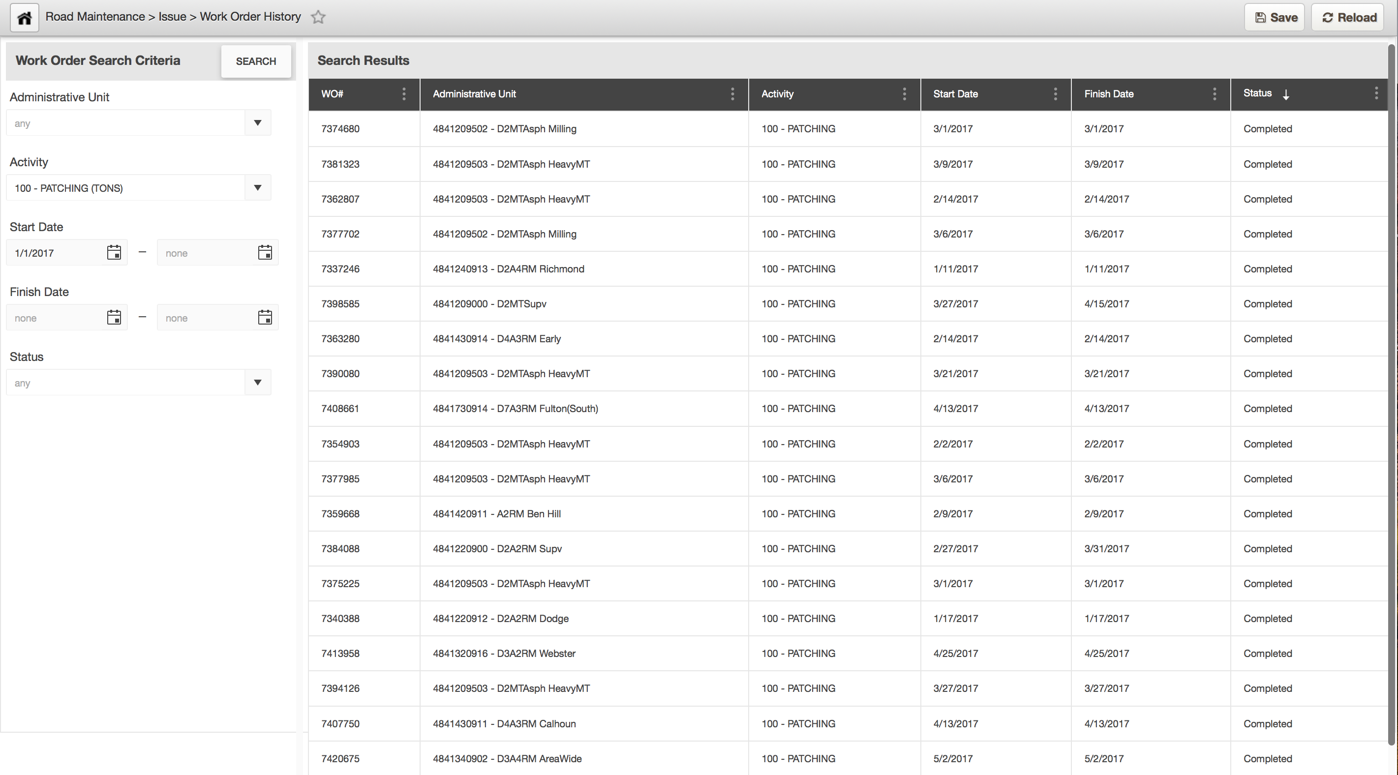
- Refreshed user interface and experience of the work order history window
Dropped/Replaced Features
- N/A
Bug Fixes and Other Improvements
- Added: Ability to edit point and linear features on a map bound to a data window
- Added: Ability to define up to four fixed columns (these will remain visible, when scroll horizontally) in a data window display
- Fixed: Issue in Signs Inventory, where placing the cursor in the MP field for a row, and then clicking away, causes the field data to appear as edited and the save button enabled
- Fixed: Issue in Fleet Management in the equipment inquiry window, where the field 'Select Column to Retrieve by' did not have a default value
- Fixed: Issue in Roadway and Facilities, in the in-house projects window, where the 'Update Child Projects' action did not propagate changes made in the in-house projects pane
- Fixed: Issue in Roadway, where the linear diagram displayed for a selected route, could be edited for an asset type/event
- Fixed: Issue in Signal & ITS Management, where the update time for an employee day is displayed as zeros, when the day card is approved
- Fixed: Issue in Signal & ITS Management, where the update time for a work order created for a work/te request, is displayed as zeros, when the work order is activated
- Fixed: Issue on a map bound to a data window, where a new insert-like record of an existing record, is not shown on the map until the application cache is cleared
- Fixed: Issue on a map bound to a data window, where a row selection on the data window does not zoom-in the map to the feature in the selected row
- Fixed: Issue in GIS Explorer, where an edit of a feature service URL does not trigger a revalidation of the edited URL before save
- Fixed: Issue in GIS Explorer, where the map legend overflows at the top of the screen and no option scroll the content
- Fixed: Issue in GIS Explorer, where the AND operand for filtering map data, is not functional when used for 'ANDing' the same field
- Fixed: Issue in Reports, for standard reports where the title of a report are displayed twice in the report
Known Issues, Limitations & Restrictions
- The new GIS Interface like all web mapping applications requires datasets in the geographic coordinate system (EPSG:4326), so customer schemas with data stored in a different coordinate system would need to be transformed in order for map layers to be created from the dataset.
- Inserting a location or inventory item from a map is not functional when using Firefox as your web browser. To work around this limitation, use the other supported web browsers: IE 11, Chrome or Safari
- When you select to print a map as an image (png file) whilst using Firefox as your web browser, the file is downloaded as map.png.pdf. You would have to manually edit out the '.pdf' extension from the file name, after the file has been downloaded, to be able to open/use the file
- When you define a map print template of size 34x44 or larger, an error is returned since the size of the generated map image always times before a pdf for printing is generated
- While working on the GIS Interface and performing tasks that does not generate a request to the server (such as styling a map), your user session may expire as a result. The configured session expiration warnings will be displayed when this occurs or your session may timeout and a session expiration notification displayed, if a warning is not configured
- Map filter value does not get pre-populated in the Jasper report print template, even though the parameter is specified for display in the template
- Map filter value cannot be defined or edited for a map with a specified area of interest. To work around the definition limitation, the map filter should be defined before the AOI is set
- A map's layer style settings become null and uneditable, when an applied filter is partially applicable or not applicable to the defined styling attribute values for the map
- On a map bound to a data window, some items when selected on the map aren't highlighted in the data window because they aren't present there (In a data window, items can be Access Regulated), but on the map all inventory items are displayed
- The loading and display of maps and associated styles in IE 11 does not perform as well as Chrome, Firefox and Safari
- In the Roads & Highways interface, routes with curves are not handled properly by the ESRI FDGB API. A workaround is to have the agency densify the routes to turn the curves into line strings
- The HTML5 based copy/paste functionality has limitations on the number of rows that can be copied to a browsers clipboard
- IE 11 - 4000 rows
- Edge - 4000 rows
- Chrome - 400 rows
- Firefox - 1000 rows
- IE or Edge on a Surface Tablet - 15 rows
- When you select to copy rows from a data window, data from hidden columns on the window are also copied to the clipboard
- The spinner indicating that a layer is loading in the GIS Explorer, continues to spin after selecting to remove a previous loading layer by using either the new map or remove layer option
- When zoomed in at the 0.6km/0.4m level before selecting to print a map, the basemap is not rendered on the resulting printed map
- Hebrew and other languages with special characters are not rendered properly on the properties panel of GIS Explorer
- GIS Explorer does not display the contents of the screen for a right to left language setting
- The owner of a GIS catalog folder no longer has access to the catalog, when the folder is shared by a GIS admin with administrative units that the owner of the folder does not belong to
- A map built from an image service is not rendered in the printed document (pdf or png) when select to print the map
- An image layer is not displayed on the map when change the basemap from the 'None' option to any other basemap option
- A map comprised of layers from multiple sources including an image service, does not display the layers in the correct z-order when the layers are re-ordered
- For some monitor resolutions, opening the messages dialog while the GIS Explorer window is open results in the messages dialog to be partially hidden
- In FDC, when enter an incorrect password twice and then enter the correct password afterwards, a message indicating an incorrect reCAPTCHA answer is displayed
- When the same editable layer is added to GIS Explorer so there are more than one active, the features on the layer cannot be dragged for an edit
- The undo/redo of edits retains the actions performed even the associated layer has been removed
- When add a new editable layer to a map with in-progress edits, the undo and redo options are temporarily disabled. Performing an edit re-enables undo/redo and previous edits can be undone or redone
- When a user a user enters an incorrect username or password in the Work Manager mobile app, an incorrect message 'Unable to connect to server' is displayed
- In Microsoft Edge, some admin units in the Admin Units dropdown on the inspection teams creation dialog, appear as actionable links
- Setting some columns as fixed in a data window is not functional in IE 11
- Setting of columns as fixed in a data window is not supported in right to left language displays, such as for Hebrew or Arabic, i.e. only the left most columns can be fixed